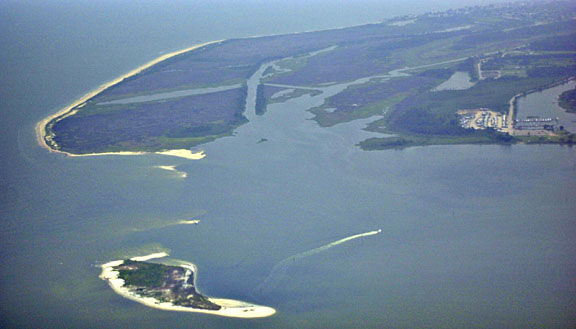
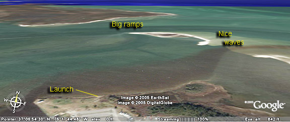
When the winds are too offshore for Buckroe, a South shore launch here will be a good choice. Sailing out to the point, which is part of the Grand View Natural Preserve, will allow you to carry your gear over to the bay for open water sailing. You can also stay in the protected river for flat water slalom sailing.
The bottom is sandy to muddy but the mud is pretty clean. Booties are recommended due to small muscles and other shells found along the shore and in the shallows.
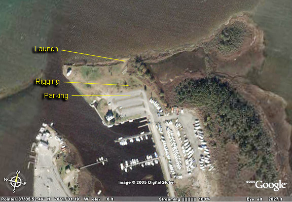
Launch sites include Bell Isle Marina half way down Dandy Point Road in Grand View. The marina management encourages windsurfers and kitboarders to sail there. They only ask that you sign a waiver in the office that is good for the year. Also, do not park on the grass. The North shore launch is at the public boat ramp at the end of Poquoson Avenue in Poquoson.
Bad points: Almost too shallow at low tide; can be infested with mosquitos, might find a snake.
South shore:
From Beach Sports drive West on Buckroe Avenue (away from the water) to Old Buckoe Road. Turn right and continue a couple of miles to Fox Hill Road. Turn right then turn left onto Beach Road. The Zooms that you pass will be the last chance for food. After a couple of miles, turn left onto Dandy Point Road. Look for public boat launch sign. About half way down Dandy Point Road, turn right into Belle Isle Marina and go to the water. Do not park in the grass.